
Words · Islas Canarias
San Borondón, the island you can only watch
For centuries islanders saw it on the horizon, sailed after it and lost it. It lives on in every telling.
By Luz Lobos · 2026-10-10
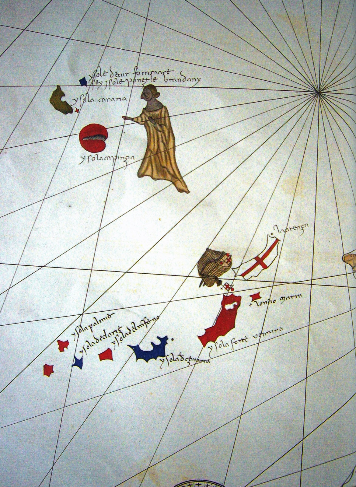
There is an eighth Canary island that appears on no modern map. It is called San Borondón, and those who claim to have seen it say it rises west of La Palma, El Hierro and La Gomera, its peaks wrapped in haze, only to fade the moment anyone sets a course for it.
The name comes from St Brendan, an Irish monk of the sixth century. A Latin tale written around the ninth century, the Navigatio Sancti Brendani, follows his voyage across the Atlantic. In its best-known scene the monks land on an island, light a fire, and feel the ground begin to move: they are standing on the back of an enormous fish.
Medieval mapmakers drew it near the Canaries, as on the Pizzigani brothers’ chart of 1367. The 1479 treaty between Castile and Portugal already counted it among the islands of the archipelago, though one still waiting to be claimed.
People did go looking: in 1526 from Gran Canaria, in 1570 from La Palma, in 1604, when they found nothing but cloud, and in 1721, on the last official expedition. In August 1958 the newspaper ABC printed a photograph taken from La Palma by Manuel Rodríguez Quintero.
Science speaks of a superior mirage, layers of air at different temperatures that throw the outline of La Palma far out to sea. On the islands, though, the story is still told the same way, the way people tell things they would rather not explain completely.